Domestic Hiking Trail Recommendations | Road Underfoot, Poetry in the Distance
Read, share, and explore related stories through curated categories and tags.
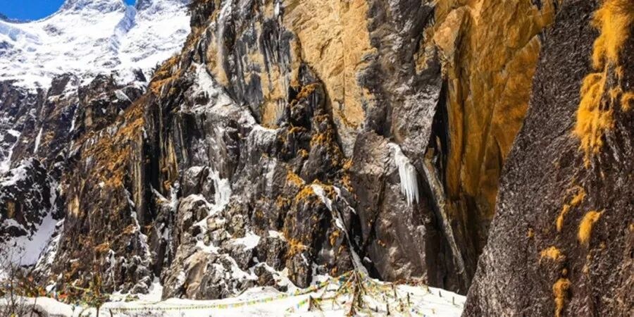
A lot of the time, I feel that hiking itself isn’t the goal—it’s about leaving the beaten path, looking back or observing from the sidelines, walking through uninhabited wilderness, and then yearning for the warmth of human life. Gazing at mountains and rivers isn’t about stirring pity in us; it’s about transcending loneliness and finding broad-mindedness from then on. Even when we put down our trekking poles, the mountains and rivers still remain in our hearts.
Hiking is a modern way of traveling—walking through vast grasslands, layered mountains, deep forests, and expansive deserts. The endurance and peace experienced along the way are beyond words. There’s the tranquility of green grass swaying in the wind and clouds drifting across the plains; the pouring rain turning the unknown road ahead into mud; the majestic beauty of a Milky Way-like waterfall and snow-capped peaks lined up; the bleakness of a long, silent journey and the confusion when rivers are blocked by ice.
What makes hiking so exhilarating might not be the rare and stunning scenery, but the self-reflection that comes from moving through the world on your own strength. It often heals the body and mind that can’t be cared for in the hustle of city life and daily routines.
Hiking is also the simplest ideal—as long as there’s a path ahead, you can weather storms, rainy nights, and scorching sun.
— Mo Bai Fei Li
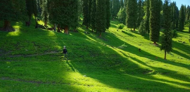
Nostalgia is a kind of elusive state of mind.
Anything that stirs the heart can create a realm through emotion.
The love for landscapes has existed since ancient times.
Whether it’s Su Shi’s “a straw cloak in wind and rain, I’ll take my fill”
or Xie Lingyun’s “mountains and rivers gleam with pure light,“
both reflect the human world and emotional landscapes built in the heart when facing nature.
Mofang user “Mo Bai Fei Li” has carefully compiled
a selection of excellent domestic hiking trails.
Now, let’s take a look.. Yunnan, Inner Pilgrimage of Meili
Rushing waterfalls and blooming flowers amidst myriad snow-capped peaks,
The icy lake’s deep reflection asks of mortal and immortal realms.
A heart of reverence must be held and kept,
Not every high peak is meant to be climbed.
As a Tibetan saying goes: “Kawagebo’s form is like eight radiant stupas… To pay homage with a sinful body makes it hard to fulfill one’s wishes.”
Image credit: Molihome user · Guomang
Kawagebo, the main peak of Meili Snow Mountain, is the foremost of the eight sacred mountains in Tibetan regions. At an elevation of 6,740 meters, it is the highest peak in Yunnan Province, situated in the area where three rivers converge. The Meili Kora is a significant pilgrimage route for Tibetan devotees from places like Markam.
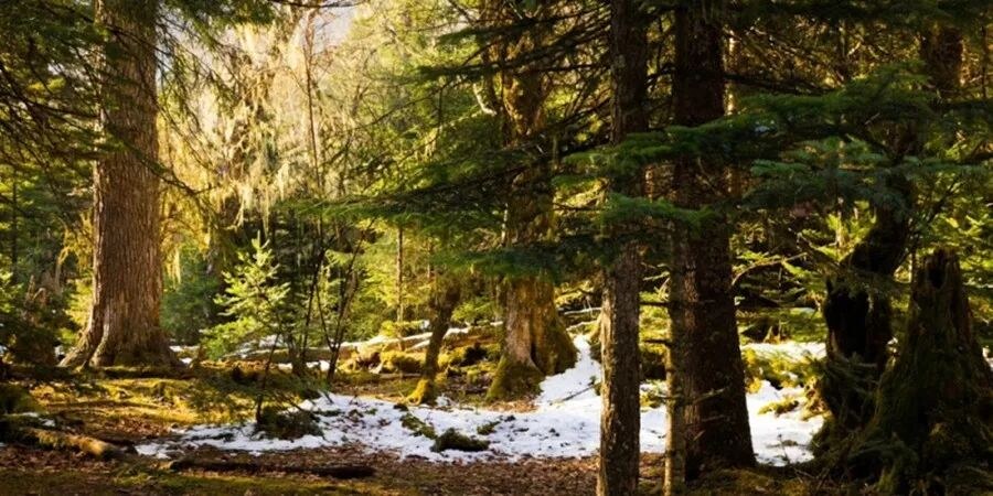
The Meili Inner Trekking Route starts from Feilai Temple in Deqin, driving along the Yunnan-Tibet Highway (which is even more perilous than the Sichuan-Tibet Highway), following the Lancang River Grand Canyon to Xidang. From Xidang, it’s an 18-kilometer, 6-hour hike to Yubeng Village, the heart of Meili, at an altitude of around 3,000 meters.
Leaping rivers, meadows, forests, upper and lower villages, sacred waterfalls, glacial lakes, colorful prayer flags, bright and holy snow mountains under the sun, and golden prayer wheels. If there truly is a “paradise,” it must be in Meili.
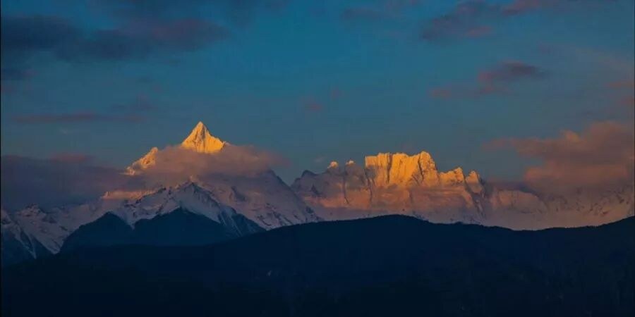
- Siguniang Mountain in Sichuan, traversing from Changping Valley to Bipeng Valley
A traveler from afar knocks at the clouds’ gate,
Deep valleys and towering peaks are no great weight.
In life’s drift, I ask my wandering dream,
Are there still mountains in this world unseen?
The elegant Siguniang Mountain near Chengdu consists of four snow-covered main peaks, stretching in a line from north to south, with heights of 6,250 meters, 5,355 meters, 5,276 meters, and 5,038 meters respectively.
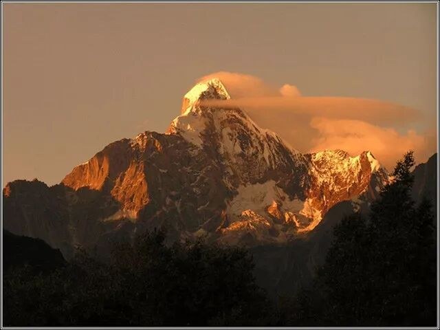
The highest peak is Yaomei Peak, of which the third peak is a beginner-level technical snow mountain suitable for experiential climbing. Changping Valley is the main valley of the Four Sisters, while Bipeng Valley lies at the northern foot of the Four Sisters.
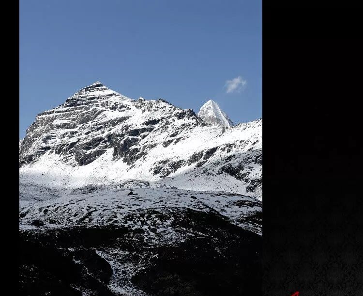
Image The hiking route from Changping Valley to Bi Peng Valley was once part of the Ancient Tea Horse Road, known as the “Tangbai Ancient Trail.” It spans 30 kilometers, takes 2 days, and crosses a mountain pass at an altitude of 4,668 meters. 3. Kanas, Xinjiang — A two-day hike from Jiadengyu to Hemu
Autumn winds blow gently along the long horse trail, mist clears among the woods as yellow leaves fall.
Where the clouds part around the snowy mountains, who could doubt Hemu is a fairyland?
Kanas Lake is a moraine lake nestled deep in the Altai Mountains of northern Xinjiang. In Mongolian, its name means “lake in the gorge.” It is formed by glacier meltwater carrying blue-green and milky-white minerals, and the surrounding mountains are covered with Siberian larch, Korean pine, and white birch.
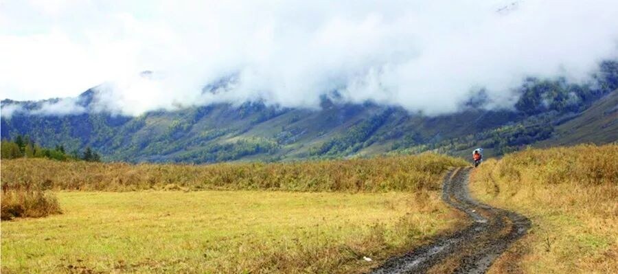
Image credit: Mofang user Mo Baifeili
The Burqin River and the Irtysh River flow with crystal blue waters, framed by trees along the banks—sometimes rushing wide and open, sometimes tranquil and distant. In late autumn, the trees on both sides of the valley are a mix of yellow and green across the mountains, with cattle, sheep, and horses often scattered on the riverbanks and hillsides.
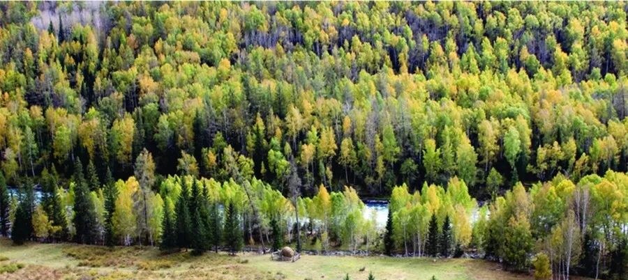
Image by: Mofang User · Mobai Feili
In the early morning, white mist spreads and drifts gently. Under the clear sky, the heavens stretch high and the waters run far, with birch forests shedding colorful leaves. Not far from Kanas, the village of Hemu, nestled among snow-capped mountains and accompanied by the Hemu River, feels like a world forgotten by time.
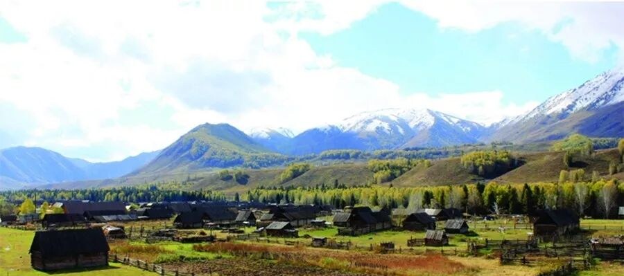
Image by: Mofang user · Mo Baifeili
A low-difficulty hiking route from Jadengyu in Kanas eastward to Hemu Village, covering about 35 kilometers and taking 1-2 days. 4. Xinjiang, Six-Day Trek Across the Wusun Ancient Path
Yearning to cross the Tianshan snows deep, where ancient battles have turned to dust.
The icy lakes dye the mountains blue, lend me a pure heart to stand here.
There are actually many routes that make up the Wusun Ancient Path, which connects the northern and southern Tianshan Mountains—the Duku Highway and the Xia’te Ancient Path are both part of it. During Emperor Wu of Han’s reign, ties were forged with the Wusun; under the Sui and Tang dynasties, the Western Turks ruled the Tarim Basin; and in the Tang dynasty’s campaigns against the Western Turks, the Wusun Ancient Path was a must-travel route. The hiking route commonly known as the Wusun Ancient Trail is actually called the Baozhadun Wusun Ancient Trail. It’s one of the three most challenging routes in Xinjiang, stretching 140 kilometers from Qiongkushitai Village in Tekes County, Ili Kazakh Autonomous Prefecture in the north, to Heiyingshan Village in Baicheng County, Aksu Prefecture in the south. This trail served as the path for the ancient Wusun Kingdom to cross the northern and southern Tianshan Mountains to reach the Qiuci Kingdom (modern-day Kuqa area).Going upstream along the Qiongkushitai River, following the livestock path carved into the steep cliffs, crossing the Kekesu River by zip line, and traversing the black mountains dotted with snow, you’ll come across a blue paradise lake hidden within the snowy peaks.Image 5. Litang, Sichuan — A Nine-Day Trek Through Genyen Holy Mountain and Maoya Grassland
The highlands are harsh and wild, leaving one feeling utterly destitute;
The vast grasslands roll on and on, as if forgetting the many passes.
How lovely that the mountain monks welcome the wandering guest,
Not letting the rain and mud seep into the heart.
Genyen Holy Mountain is one of the sacred sites of Cakrasamvara in Tibetan Buddhism and the birthplace of Tibetan Buddhism in the southern Kham region. It is located in Reke Township, Litang County, Sichuan, and its Tibetan name is “Khamaripa.”Image by: Mo Fang user - Guo Mang
The main peak, standing at 6,204 meters, is covered in snow year-round, towering and cold, surrounded by peaks like Xiaoza and Cameroon, as if guarded by deities. The G聂 hiking route stretches from Lamaya Township to Gemo Village in Bomi, Batang County. Along the way, the views are vast and magnificent, with snowfields, lakes, streams, and meadows interwoven—picturesque yet tough to traverse.Image The Lenggu Temple deep in the valley, founded by the first Karmapa of Tibetan Buddhism, Dusum Khyenpa, has a sense of standing apart from the world. Here, one can witness the splendor of the golden mountains under the sunlight. 6. The Great Traverse of the Hengduan Mountains
A journey through Hengduan can make one a legend; why chase fame or glory day and night?
Thousands of rugged miles, full of hardship, yet with a confident smile, I press on.
The Hengduan Mountains, a general term for a series of north-south parallel mountain ranges in southwestern China, include the Boshula Range, Gaoligong Mountains, Nu Mountains, Yun Range, Daxue Mountains, Qionglai Mountains, and Minshan Mountains. This is a mysterious region in Chinese civilization, where six rivers—the Nu, Lancang, Jinsha, Yalong, Dadu, and Min—flow southward, nurturing over twenty ethnic groups. Crossing the Hengduan Mountains from north to south, walking atop the stairway to heaven. This ultra-long hiking trail, stretching about two thousand kilometers, can be considered a national-level hiking route in China. From Yunnan to Gansu, with countless high snowy mountains, barren wilderness, forest canyons, and raging rapids, it is a land full of adventure. With immense elevation changes, complex and varied terrain, and paths that are hidden or have vanished, only the Ancient Tea Horse Road once traversed here. This is a wild road back to nature.
It’s not easy for multiple teams to survey different sections, and even more remarkable are the brave souls who traveled a thousand miles alone. Life may have no answers, but from certain perspectives, it can get closer to the truth. 7. Inner Mongolia, Badain Jaran Desert Crossing
Westward thoughts recall the distant march, the shifting sands hide in phantom forms.
Don’t say the frontier lacks beauty—extreme colors bloom in extreme lands.
The Badain Jaran Desert is the main part of the Alxa Desert, where endless sand mountains flow slowly through the vast sea of sand. Soft or sharp ridges sketch out a silent and desolate world.Image Dense sand dunes rise two to three hundred meters high, with the tallest reaching five hundred meters. Lakes are scattered among them, and tough desert plants survive here—this is a no-go zone for life. In the northwest part of the desert, over 10,000 square kilometers remain untouched by humans.
Crossing the desert, from Gurinaisumu in Ejin Banner to the entrance of the desert scenic area in Alxa Right Banner, the journey spans 200 kilometers and takes 9 days. 8. Rock Line in Sichuan, from Muli to Yading
Clouds sweep over wild tents in restless streams,
Rivers grow chilly as autumn quietly gleams.
Pity that passion births hell’s fiery plight,
Sacred peaks in snow find mercy’s light.
This is a route full of intense scenery. Starting from Muli’s Shuiluo Village, it goes up the Baimu River, circles around the three protector mountains—Xiannairi, Yangmaiyong, and Chanoluoduo (associated with Avalokiteshvara, Manjushri, and Vajrapani)—and finally reaches Kasi Village in the Kasi Hell Valley.Image courtesy of Mofang user Huang Ying.
Because this route follows the path of the explorer Joseph Rock through this hidden realm, it is also called the “Rock Trail.” With towering snow-capped mountains, a deep blue sky, pure alpine lakes, fluttering prayer flags, lush river valleys, and the quiet beauty of autumn leaves, this is the legendary prototype of “Shangri-La.”
The trek goes from 2,200 meters to 5,100 meters in elevation, with most of the journey hovering around 4,000 meters. It covers 90 kilometers in total and takes 5 days. 9. Xinjiang Tianshan, Langta C Route
Westward on the Langta trail, the road stretches vast and dim,
Night tents chill with frost, a cold coating on the rim.
Perhaps it’s solitude too deep for words to mend,
Staff in hand through ridges and crags, from heat to cold I wend.
In Kazakh, the 5,290-meter Heyuan Peak in the eastern Tianshan is called “Langta (Lant)”, meaning vast pastures. The Langta C Route starts from the Hutubi Grand Valley near Ürümqi in northern Xinjiang, crosses five mountain passes over 3,000 meters, and reaches Baluntai in southern Xinjiang. The journey is about 140 kilometers, traversing the Tianshan from north to south.Image In the Kazakh language, the Hutubi River means “a place where spirits roam.” It originates from the Heyuan Peak and eventually flows into the vast Gurbantunggut Desert. The river valley features steep cliffs on both sides, swift currents, dense forests that block out the sun, and perilous, winding plank paths.Image credit: User Dongdong from Mofang
The Langtan C Route is one of China’s most high-risk hiking trails, requiring 6-7 days to traverse the entire route. It’s desolate and wild, so much so that even herders rarely set foot there now. Along the way, there’s over a hundred kilometers of uninhabited area, plus you have to cross icy rivers multiple times and trek over snow-covered icy passes.
Though long and perilous, the mist-shrouded valleys and the jagged, snow-covered peaks along the Langtan Route possess an extraordinary grandeur.Image 10. Medog, Tibet: A three-day trek from Pai Town to Beibeng
Secluded peaks recall old glories, fate slips like sand in hand.
At mountain tops, ice cracks and wild winds rise—who once lost their bloom in Tibetan lands?
Medog, on the southern slope of the Himalayas near Nyingchi, Tibet, is also known as “Baimagang,” meaning “flower” in Tibetan. The Kangyur, a key text of the Tibetan Buddhist canon, calls it “Baimagang, the pure land of Buddha, the most sacred of the sacred.” For Tibetans, it is a “lotus treasure land.” Medog was once the only county without road access, regarded by many as sacred and mysterious. Located in a humid climate zone, it is covered with dense forests and lush flowers and trees.
Starting from Pai Town, one must trek over the 4,200-meter-high Duoxiong La Snow Mountain to enter Medog. The entire journey is 78 kilometers and takes 2–3 days, requiring particular caution against landslides and leeches. The crossing of Duoxiong La Mountain must be completed during the day, as cold weather and the risk of getting lost after dark can be deadly. 11. Tibet, Mount Kailash
Spending the night in a temple, watching prayer flags in the wind; at the pass, the wind subsides, and the snow grows harder.
The world’s most difficult pilgrimage path; even with a full moon, reunion remains incomplete.
Ngari Prefecture, Tibet, Gangdise Mountains—known in Tibetan as “Gang Rinpoche.” They look up with faith, enduring immense hardship with deep devotion, dust-covered and prostrating every step of the way, living a life bowed only to the heavens and the earth.
Mount Kailash, the center of the world (Mount Sumeru in Buddhism). Standing at 6,638 meters, it is the birthplace of many religions. The circumambulation ritual, popular in Tibetan Buddhism, originates from the indigenous Bon religion of Tibet. Mount Kailash has a unique pyramid-like shape that is unforgettable at first sight. The outer kora usually takes two days, starting from Tarchen Village at an altitude of 4,560 meters. Going clockwise (clockwise for Buddhist kora, counterclockwise for Bon), you pass by Choku Monastery, Drirapuk Monastery, cross the Drolma La Pass at 5,630 meters, then pass by Zutulpuk Monastery, and return to Tarchen. The entire route is about 56 kilometers.
Walking past the mani piles, you can not only see the majestic Mount Kailash, but also peaks like Mount Naimona’nyi, as well as Lake Rakshastal.Image credit: Mofang user · bijiaojie
- Xinjiang Ili Alpine Grasslands: A six-day trek from Qiongkushitai to Kuerdening
Rugged peaks, narrow horse trails, half draped in blue firs, half in blooms.
Only the snow on the mountains keeps us company; where life pauses is where we call home.
On the northern slope of the Tianshan Mountains lies a place called “Kalajun,” which means “vast grasslands” in Kazakh. Once used as a summer pasture by the Wusun people, it is now home to the Kazakh ethnic group.Image credit: MF user Crystal
This alpine grassland, as if watched over and guarded by snowy peaks, features rolling hills and valleys, towering spruce trees, blooming flower seas, and endless green grass. This hiking route stretches from the southwest to the east, crossing the Kalajun Grassland from Qiongkushitai Village to the Kuerdening Scenic Area, covering 140 kilometers over 6 days. 13. Gannan Diebu Alpine Pastures: A Four-Day Trek from Zhagana to Jonê
Endless peaks obscure the trail, yet I press on, sleeping in wind and rain along the way.
Jagged ridges stretch into the vast horizon, at night I lean by the cattle shed, boiling stars under the sky.
Zhagana Village sits on the must-pass path of the Tao-Die Old Trail, hidden deep in the mountains of Diebu, Gannan. The trek from Zhagana to Dayu Valley in Jonê crosses alpine pastures at altitudes between 3,000 and 4,200 meters, covering about 70 kilometers with a cumulative ascent of roughly 4,100 meters. Along the way, you’ll traverse 17 ridges and mountain passes of varying sizes, camp in the wild for three nights, and walk for four days.Image credit: Mofang user · Mobai Feili
The journey stretches far and wide, with gray-white stone peaks standing even more rugged above the rolling green grasslands. Along the way, you’ll see streams, canyons, wildflowers, and yaks. Though the entire route is a pastoral trail, it’s not without steep slopes, exposed Danxia gravel cross-sections, muddy mountain paths, forests, and rocky shoals—making it a moderate-intensity, high-altitude trek.
Image credit: Mofang user · Mo Bai Fei Li
Someone asked me why I love hiking, and I’ve really thought about it. Maybe only the word “sentiment” can explain it.
But no matter how deep the sentiment goes, it can’t outweigh responsibility. Whatever the purpose of hiking, or whichever route you take, if you love the mountains and wildlands, then protect them. Even a thousand years from now, the mountains will still be mountains—but the trash left along the way destroys more than just the scenery; it destroys human dignity.
May irreversible ecological harm never come because of you or me. And when hiking, being a thinking ox isn’t such a bad thing either.The wonders of the distance began in 2002. Aimed at encouraging everyone to discover, capture, and share beauty, it has been a beloved classic activity at MF for many years. We look forward to exploring the “New World” together with everyone, enjoying the scenery along the journey, while inviting more people to step into the wonders of the distance.
Post original threads on MF, and you might be featured on the homepage of doyouhike.net, the official account, and even have a chance to win a mystery prize in the annual Wonders of the Distance awards!
For 2018’s recommended outstanding works on MF, click here:
http://www.doyouhike.net/forum/jingcai/2602039,0,0,1.htmlThis article is originally compiled by Mo Bai Fei Li, a user of Mofang. Some images are provided by Mofang users. The original article, “Seven-Character Quatrains and a Thousand-Mile Journey,” was published in the “Mofang - Long Holiday Travel” section. Due to layout limitations, it has been abridged. You are welcome to click “Read the original text” at the bottom to view the full精彩 content. Thanks to the authors who provided wonderful photos. Do not repost on other platforms without permission.
Note: The overland crossings of Aotai and Nianbao Yuzhe mentioned in the original text are now prohibited.↓↓Click “Read More” for more exciting content
Tag navigation
Explore articles that share the same tag and jump to tag pages.


Category navigation
Jump to the article’s category or explore nearby topics.
Chinas erster Wanderer kommt zur Stadt Lushan: Die ganze Welt ist eine Familie, vermittelt menschliche Gefühle!
Jump to the more recent article in this topic series.
Noch mehr Freude! Vier Orte in Jiangmen als nationale Schwerpunktdörfer für den ländlichen Tourismus empfohlen!
Continue to the previous article in this series.
Related stories
More articles from the same category and nearby topics.